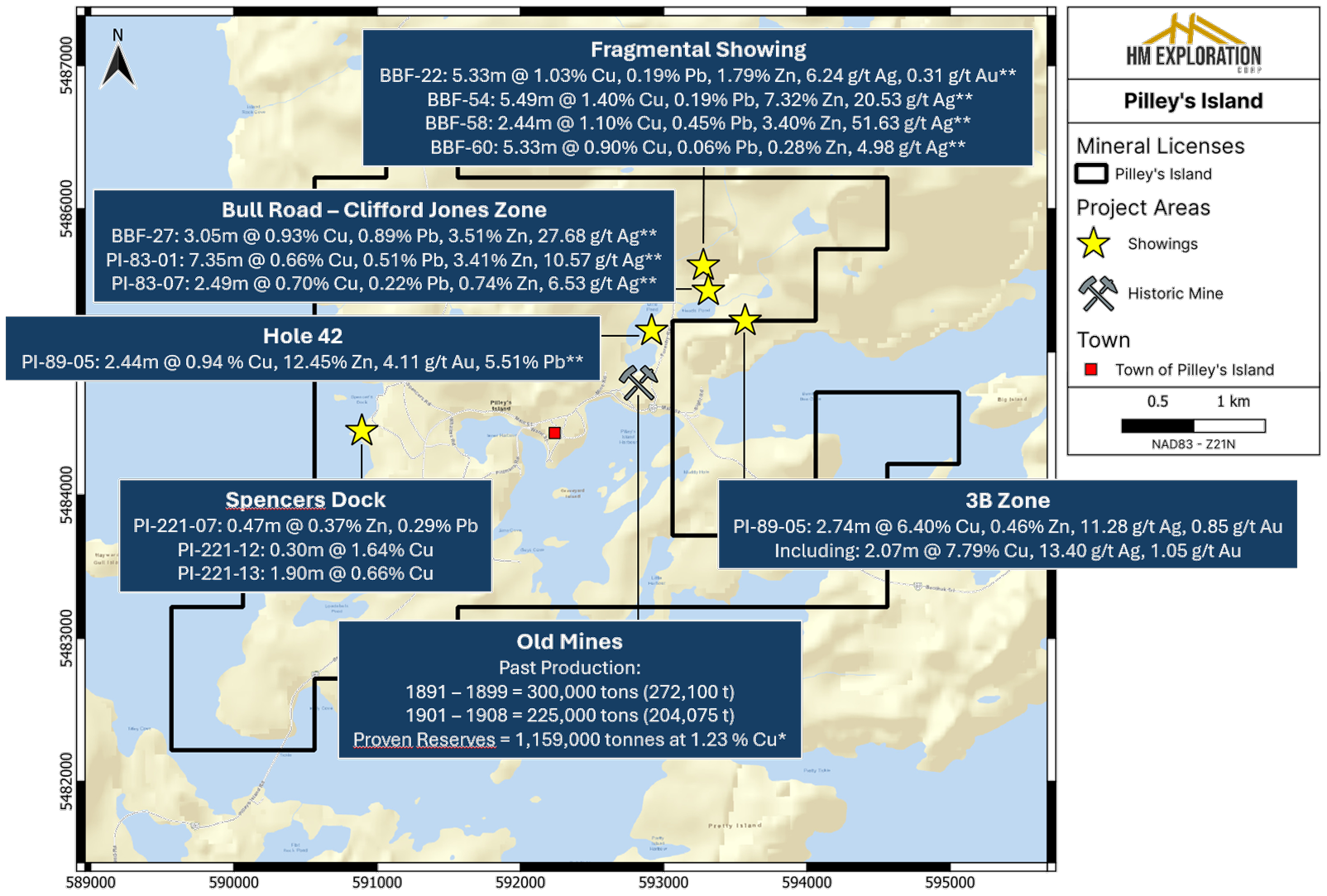
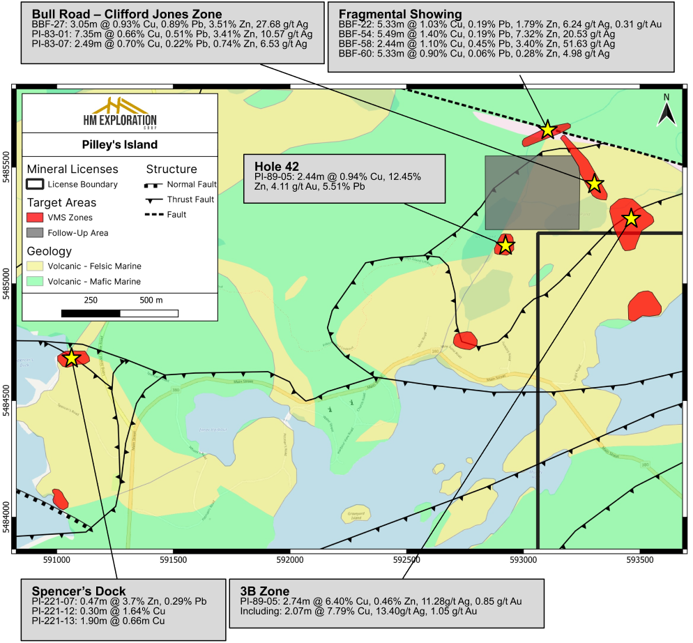
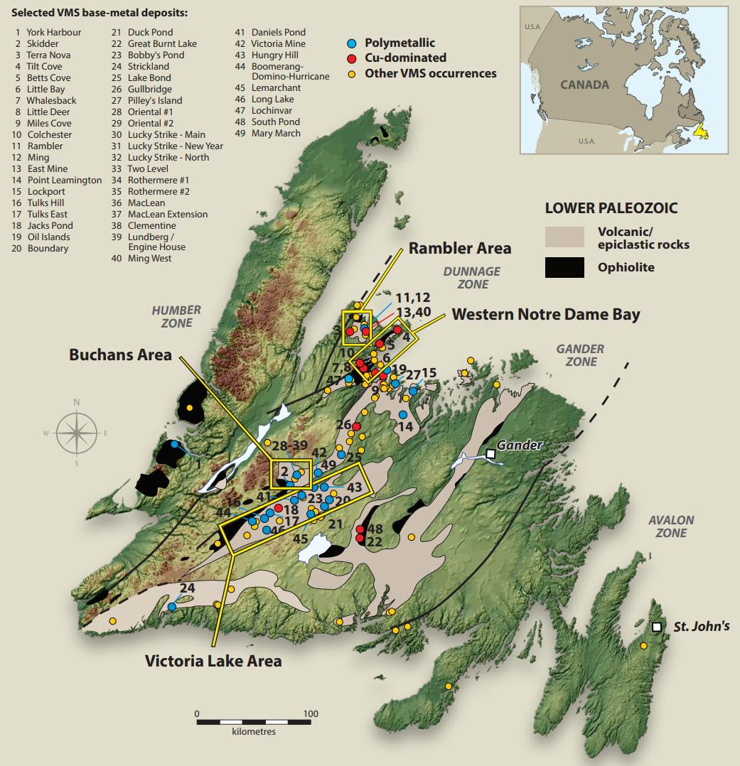
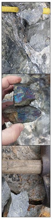
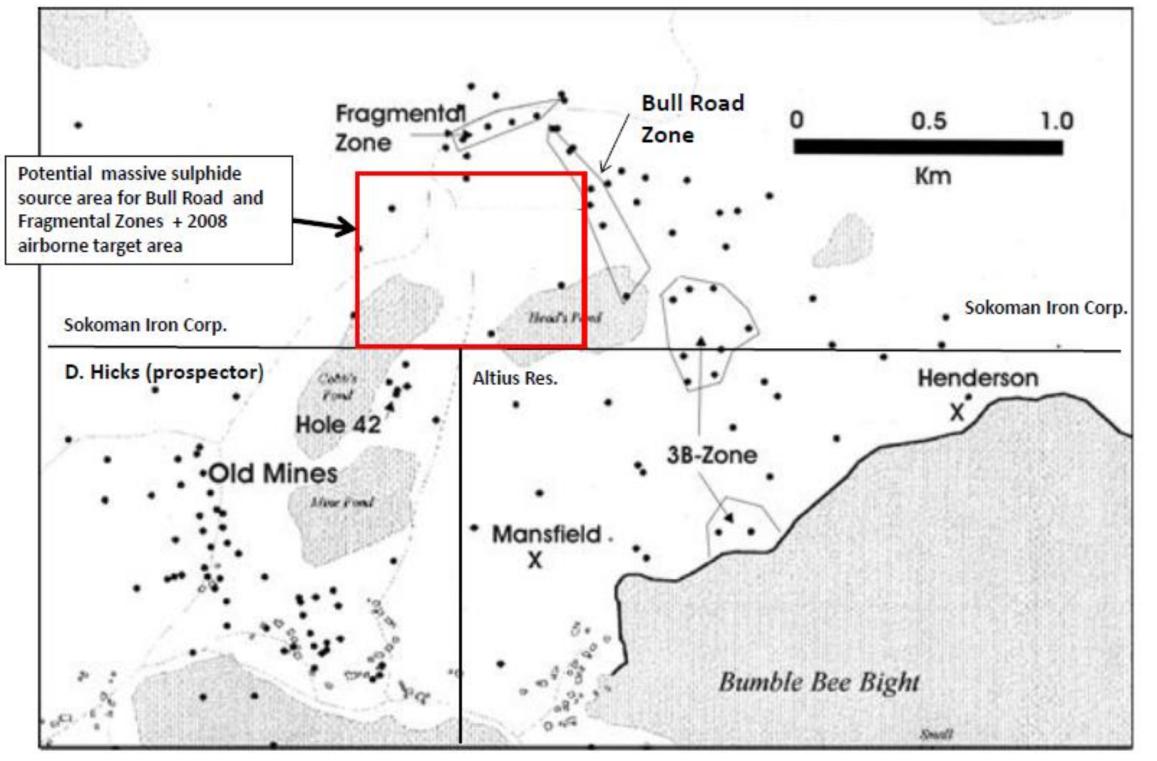
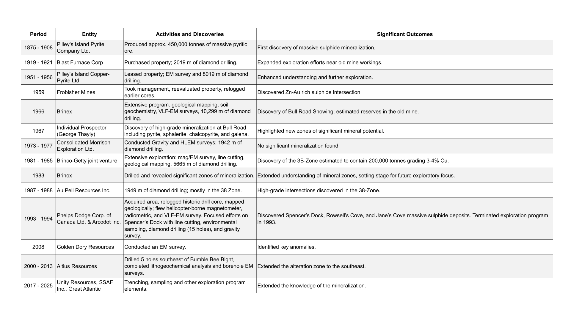
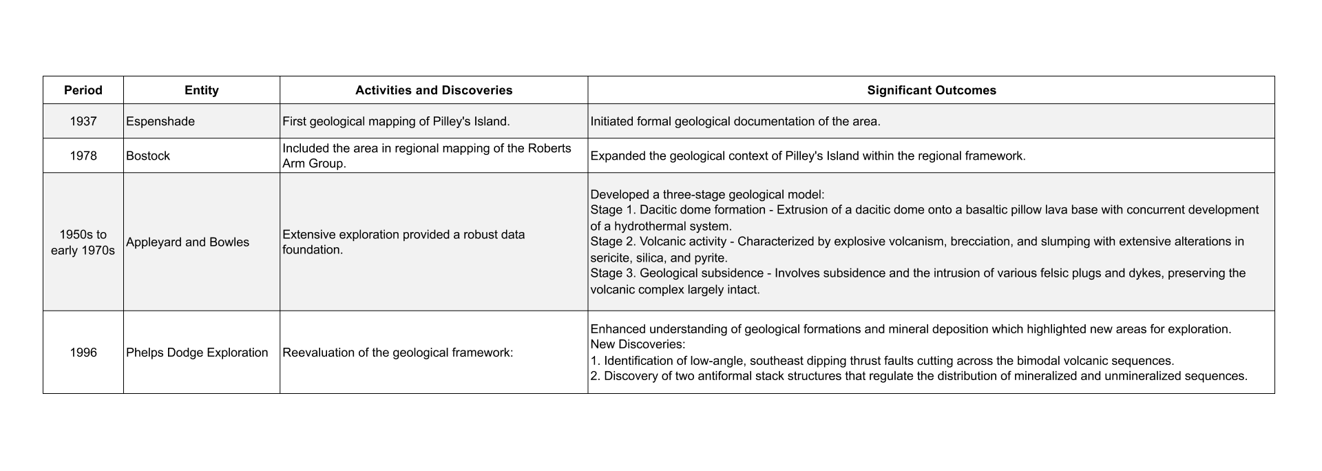
Volcanogenic Massive Sulfide
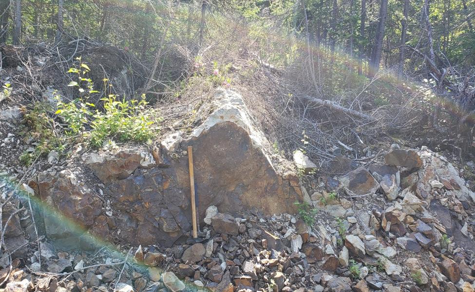
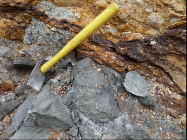
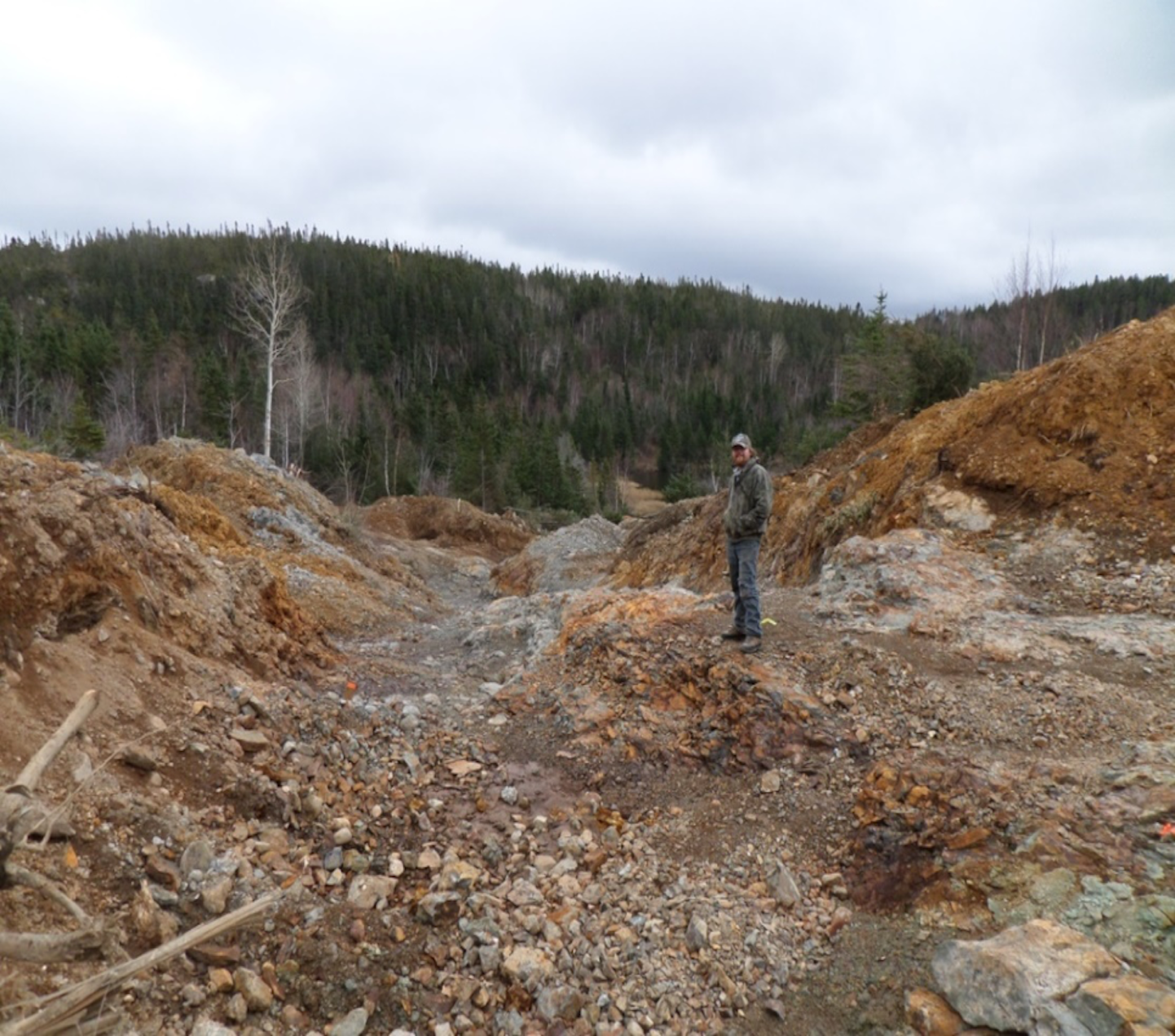
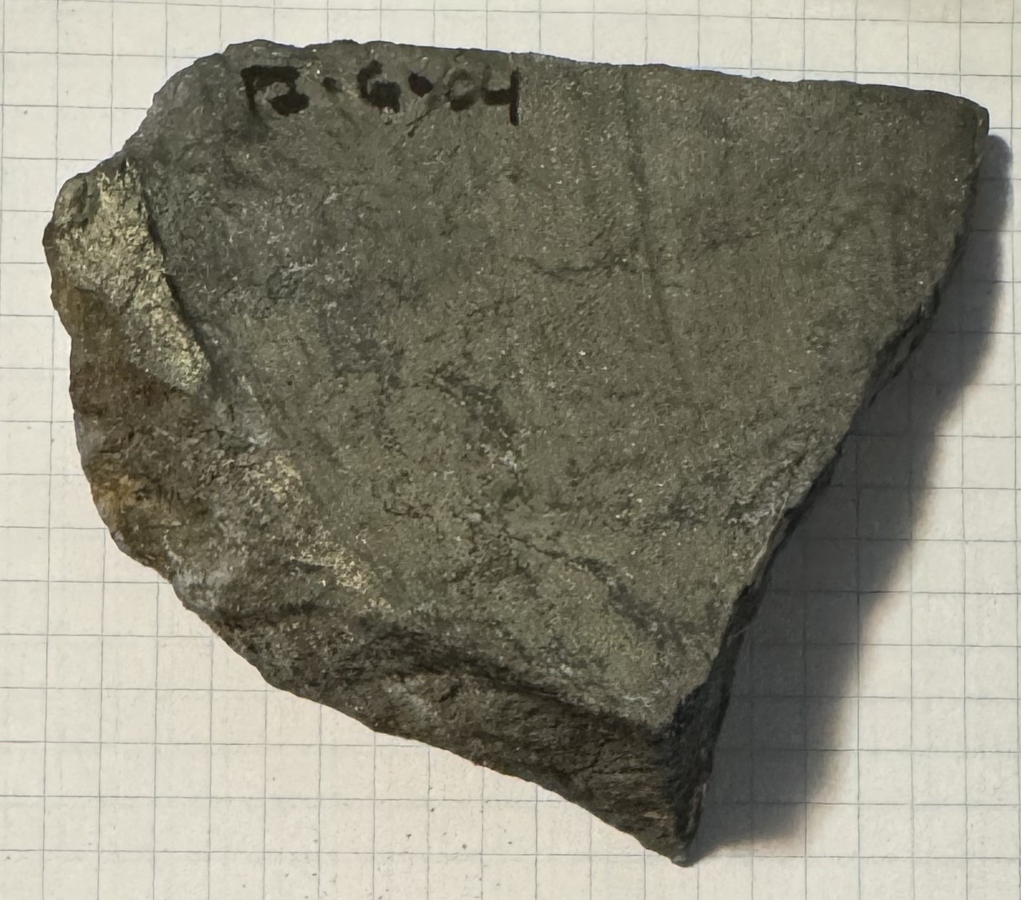
Hosts several Volcanogenic Massive Sulfide (VMS) systems with high-grade zinc, lead, copper, and silver mineralization. Its geological features resemble those of the Buchans camp, indicating strong potential for additional massive sulfide lenses.